Project Overview
Welcome to West Drayton Fish Passage Improvement Project page.
Groundwork South and the Environment Agency are working in partnership to resolve a series of issues affecting the River Colne at West Drayton Mill. This is an exciting project to improve fish passage in Colne Valley Regional Park and deliver environmental benefits as part of the Landscape Partnership Scheme.
Project Background
The Colne Valley Park has over 200km of river and canals with over 60 lakes which host a wide variety of 16 native fish species including Barbel, Chub, Dace and European Eel. A large proportion of these species are migratory so require free movement along watercourses to reach different habitats at crucial points in their life cycle e.g. spawning sites and juvenile shelters. Migration distance varies between species; for example Dace (Leuciscus leuciscus) have been recorded travelling up to 16km; but the European eels, (Anguilla anguilla) (classed as‘Critically Endangered’ on the IUCN Red List of Threatened Species) travel over 5000km from their spawning grounds in the Sargasso sea to European river systems.
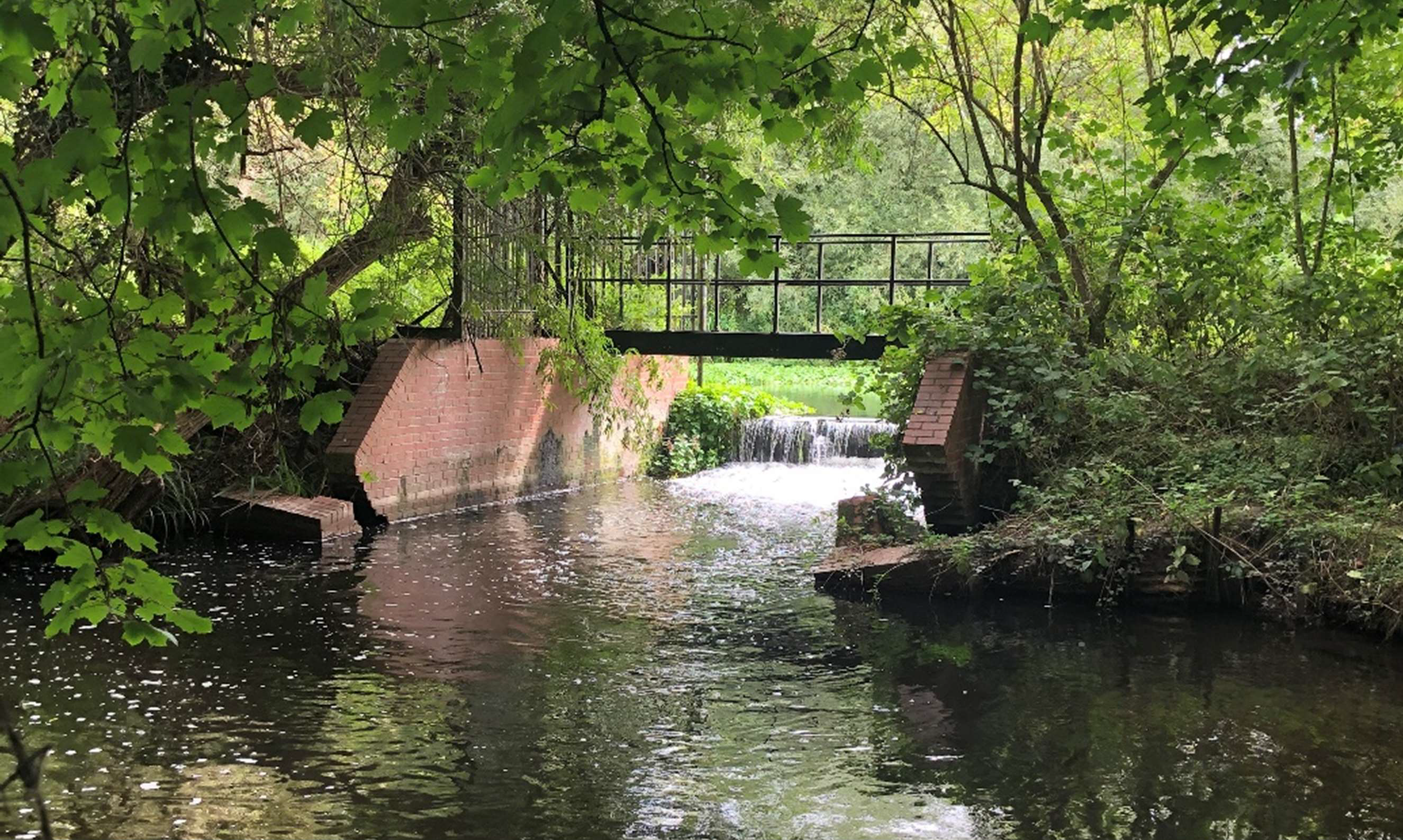
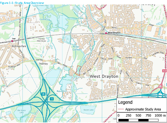
Humans have altered and modified river systems for millennia, often to suit their needs for food and water supply. The construction of weirs and sluices prevents the free passage of migratory fish upstream. This results in fish being unable to access the habitats they require to survive, thus affecting the resilience of fish stocks within the river catchment. One of these structure limiting free passage on the River Colne is Thorney Mill Weir (situated here).
The presence of Thorney Mill Weir by Thorney Mill Road has over time caused impoundment (holding back of water) upstream of the weir. The impoundment has also meant that the gravels you expect to find in a natural chalk stream have been smothered in silt, which prevents native aquatic plant growth and further degrades the habitat available to both invertebrates and fish species. This contributes to the deterioration in ecological status of the river under the Water Framework Directive (for more information see here). As a result of the slower flow upstream of the weir, Floating Pennywort (an invasive non-native species) has become more of a problem so that the stretch of the river between Frays Island and the mill weir has become less amenable to anglers.
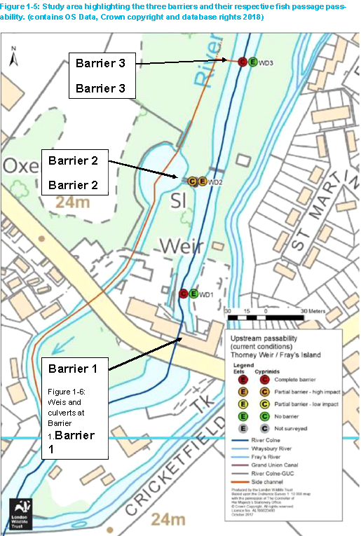
The weir also causes an obstruction to fish passage, which is only partially relieved by a side channel that circumvents the structure. There is a fish pass that connects the River Colne to the side channel but the gradient is too steep to allow all fish species to use it. Additionally, this does not address the lack of fish passage opportunities at the main weir structure. It is particularly important that fish passage is provided at the main weir structure because this is where the majority of the river’s flow is, and is therefore more attractive to fish attempting to traverse the structure.
As part of the Landscape Partnership Scheme the West Drayton Fish Passage Improvement Project has an objective to investigate the options to improve the fish passage at this structure. The most feasible option will enable free movement for fish so they can access areas previously inaccessible, which will benefit the River Colne’s biodiversity, and the wider environment.
What is currently happening?
Feasibility reports and ecological surveys to investigate a range of options for the site, have been completed. These investigations direct the next actions for the site which are currently being developed as part of the detailed design, permitting and consultation phase for the project.
This phase is an extremely detailed process reviewing potential options to improve fish passage at the site and assessing their impact on wider features such as geomorphology, flood risk and heritage, in order to gain the most benefits from the project. Groundwork South, Environment Agency, Hillingdon Council and London Wildlife Trust are involved through the design and planning process.
The impact on flood risk in the area is being modelled in a variety of climatic variations using the Environment Agency with a flood model for the Lower Colne. The project and fish passage improvement works will not increase flood risk in the area.
Next Steps
We have been investigating the options to improve the fish passage in the River Colne at West Drayton Wier. We have considered a range of options, their impact on wider features such as ecology, heritage, flood risk and the local community. The proposals presented in this leaflet are the result of this work, determining a sustainable solution which will enable free movement for fish so they can access areas previously inaccessible, which will benefit the River Colne’s biodiversity, and the wider environment.
A consultation was held to hear what local residents thought. Information about the proposals was presented in this leaflet . Feedback formed a vital part of developing the proposals and identifying any opportunities or impacts that might arise.
A Meeting was held on: Tuesday 11th October 2022 at 1:00pm – 6:30pm
Meeting location: Southlands Art Centre, 75 The Green, West Drayton, UB7 7PW
Feedback on our proposals was sought through the fish improvement consultation questionnaire, available online, at the consultation evening or with this leaflet. The consultation closed on 25th October 2022. We’d like to thank everyone who made the time to come to the consultation event and or filled in the questionnaire. We are now using the feedback to refine the preferred option and produce a final design for the project.
Contact details:
Phone: 01895760613
Address: Groundwork South, Colne Valley Park Visitor, Centre Denham Court Drive, Denham, UB9 5PG
Email: [email protected]
Download the leaflet and questionnaire here
March 2025 Update
This update is from a Fisheries technical specialist at the Environment Agency, the organisation who are currently leading on this project:
‘We are currently looking for funding to take this project forward to detailed design, fluvial modelling and delivery. Unfortunately we do not currently have the funding available to progress this project although it is still on our Medium Term Plan.’
January 2023 Update
The detailed design phase is complete. The permissions are waiting on approval from the Environment Agency. When Environment Agency approval has been confirmed, additional funding will be required to do the build works.
Further updates will follow. Watch this space.
The Environment Agency will take over from Groundwork South to become the project lead.
Contact Us
If you have a question about the project or would like further detail please contact us.
Questions and Answers and Fascinating Fish Pass Facts
What is the River Colne? Why is it important?
The Colne springs forth from an underground river located in North Mymms Park and flows south west alternating between both the urban and rural landscape typical of the south of Hertfordshire and flows down through Hillingdon and joins the River Thames in Staines. The River Colne is also a chalk stream throughout much of its length. Chalk streams are a globally rare habitat, confined to north west Europe and to the UK in particular. In fact more than 85% of all the chalk streams in the world, are found in England. The River Colne has shaped our history through local livelihoods with its influence reflected in the many locations attributed with its name. Furthermore, it provides a lifeline for food, water and shelter for all species to thrive.
What is Thorney Mill Weir?
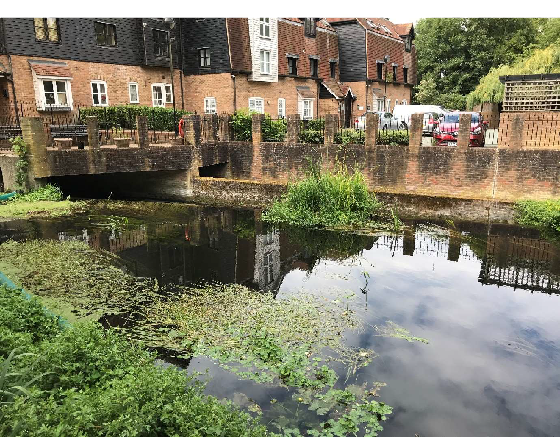
Thorney Mill Weir is an old historic mill structure which once provided a vital source of employment for the local area. Today the mill is no longer functioning and has been converted into Waterford House, a series of flats providing homes for the local community. Underneath the mill structure still lies numerous culverts dividing the river which create an impassable structure to fish and eels.
Who is involved in planning? Groundwork South, Environment Agency, London Wildlife Trust and Hillingdon Council .
What is a fish pass?
Also known as a fish ladder, or fish steps. A fish pass enables fish to swim upstream of a barrier in the river, such as a weir or a dam, by providing a route around the barrier. It can be built into or alongside the barrier. Fish passes are normally built where the barrier in the river cannot be removed.
Why is a fish pass needed?
A fish pass is beneficial as the weir currently acts as a barrier to migrating fish from the River Colne. This results in fish being unable to access the habitats they require to survive, thus affecting the resilience of fish stocks within the river catchment.
What is the Water Framework Directive ?
The European Water Framework Directive came into force in December 2003. It provides an opportunity to plan and deliver a better water environment. The Water Framework Directive requires that all European Member states’ waterbodies reach Good Ecological Status or Potential by 2027. This has been taken into UK law upon our departure form the EU.
What is impoundment?
Impoundment is the effect seen upstream of a structure within a river channel holding back water (such as a weir or a dam). This causes the water to slow down, and become ponded for several meters upstream. This ponding causes sediments carried by the river to drop out onto its bed, due to the lack of energy within the water column. Over time, silt can build up behind structures and prevent the exposure of lovely clean gravels and clear water that we associate with chalk streams.
How will this benefit me?
The project aims to provide sustainable solutions to resolve barriers to fish migration, issues affecting the river corridor and associated species. It will enable free movement for fish for them to reach areas previously inaccessible so increasing the amount of fish seen upstream and encouraging high species diversity.
Will I still be able to walk through Mabey’s Meadow & Frays Island during the fish pass works?
Yes, walking routes and throughfare will still be accessible in the nature reserve with diversion signs in place.
What trees will be removed?
Some trees where the fish pass is being installed may be removed to ensure safety and constructability of the fish pass. This and mitigation are yet to be determined.
How will we be notified about the works?
Information will be available on this webpage so please check at regular intervals. Other forms of communication are also planned: letter drops for surrounding residents, posters around Mabey’s Meadow & Frays Island, article updates on the Colne Valley Regional Park website; social media and public consultation event.
